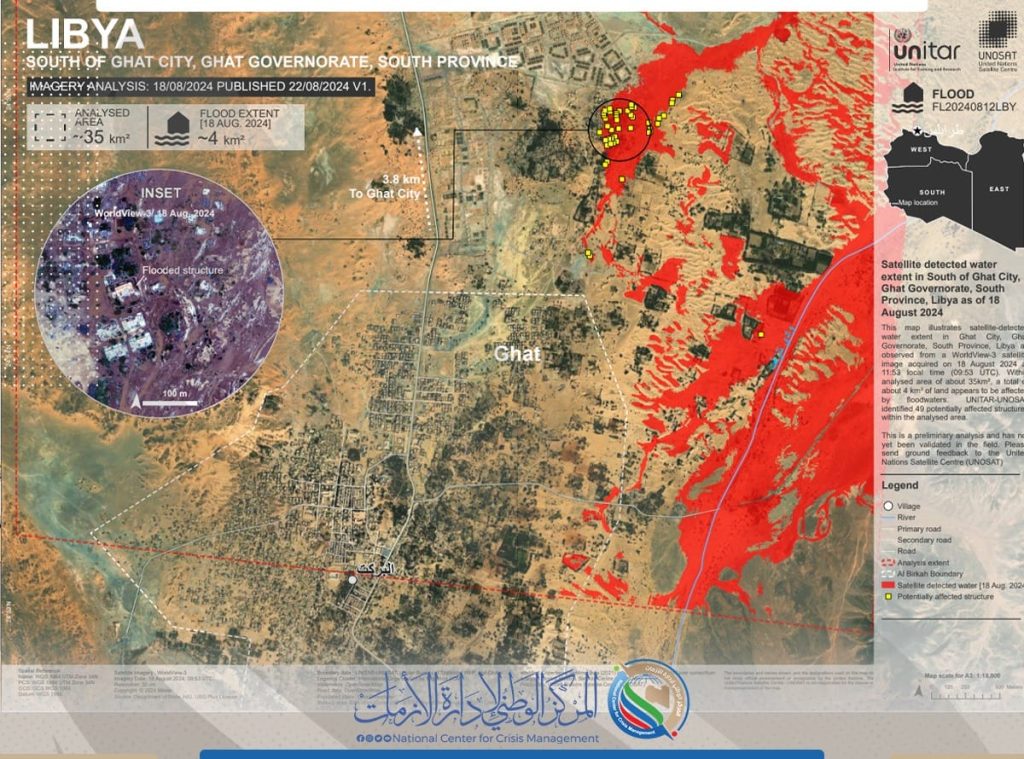
UNSAT provides the National Center for Emergency, Crisis and Disaster Management with a photo of the Ghat floods.
As part of the cooperation between the National Center for Emergency, Crisis and Disaster Management and the United Nations Satellite Centre (UNSAT), UNSAT published on August 22 an image of an area south of the city of Ghat showing that 4 square kilometers of the area were affected by floodwaters, out of a total area of 35 square kilometers. The image was analyzed using a satellite image taken on August 18 by the World View 3 satellite.