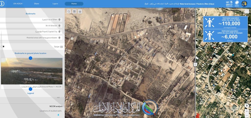
UNSAT provides the National Center for Emergency, Crisis and Disaster Management with a satellite image showing the areas affected by rising groundwater levels in Zliten.
For the second time, UNSAT provides the National Center for Emergency, Crisis and Disaster Management with a new satellite image on the web map of Zliten, taken on February 15, 2024, via the World View 2 satellite.